ROVR is one of my most bullish projects.
Firstly, just from a team perspective, they are very open about what they are doing and their technology. You ask a question and you get an answer, including the details about how they are implementing the technology on both hardware and software side. Logistics are also on point; so far to date they have announced and kept their shipping targets.
From a technology perspective they are unique. Yes, there are other mapping projects, but none that deploy lidar. Other mapping technologies have their benefits, but in terms of raw depth resolution and accuracy performance none of them reach lidar precision. Couple with the lidar precision they also deploy Geodnet’s RTK service, which localizes to within a few cm accuracy. Other projects have good performing GPS, but it’s still an order of magnitude less accurate. That being said, the other mapping projects aren’t specifically trying to do exactly the same thing as ROVR so they don’t directly compete with each other on all of their products. But take both the sensing and positioning accuracy of the LC device and you have a much cheaper, although not as robust, lidar mapping system compared to a Waymo or other lidar-enabled vehicle. The lower price is key here as it allows mass adoption on a consumer level, with adoption being promoted by the ability to earn via web3.

In the world of vehicle (or any robotics) autonomy the ability to locate yourself is key. As such the critical data that these vehicle/robotics companies use is HD map data, which is ROVR’s primary data product. Any company that wants to enable self automation and navigation needs to either buy mapping mapping AI from other companies, or develop their own, either of which requires highly accurate maps. Google/Waymo is the leader here today. Not only did they originally go gather all of this mapping data themselves, but now they are constantly refreshing it with the Waymo vehicles; the vehicles use lidar for obstacle and collision avoidance, but at the same time they are generating depth maps of the roads to continue to retrain their mapping algorithms. Waymo then takes this data and releases it to the public to use for others to train their mapping algorithms. Additionally Tesla, which does not use lidar on their consumer vehicles, still relies on lidar to baseline their camera systems off of a more accurate ground truth. Lidar ground truth for HD maps is so important that Tesla is actually the largest customer of Luminar, one of the automotive lidar suppliers.
ROVR has created their own open dataset for industry and universities to utilize. Unlike the Waymo dataset, which is located based on where Waymo has authorization to operate, the ROVR dataset is global over vastly different environments and conditions. The variability in the data is crucial for companies to train their algorithms. A self-driving company targeting the UK or Asia market is going to have a very hard time using Waymo training data from US roadways. And thanks to the relatively cheap price of the LC it can gain much more adoption from web3 users compared to the cost of a mapping vehicle purchased by large companies; as a result the amount of road km in the ROVR dataset dwarfs other open-source options:

The dataset is open and available for training, a key strategic decision. The more companies that use the ROVR data to train their automation AI, the more the ROVR data becomes an industry standard, and the more companies that ultimately need to pay for for commercial use of the data.
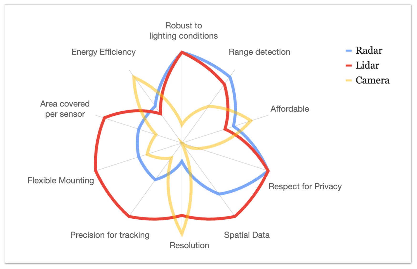
The second technology prong from ROVR is the TX. The LC, which is the lidar device, ultimately defines the ground truth data. The TX, which is the RTK antenna that pairs with your cellphone, is the validator. Although TX devices do generate some mapping data, they are at the same time validating the LC data. Additionally since the TX is a camera-based system it helps fill the gaps from the limitations of the LC. The LC can make great depth maps, however it can’t see sign figures; it sees a sign but it can’t read it. The TX helps locate objects and provides classification segmentation to help round-out the total ROVR data offering.
Ultimately the technology leads to customers, and revenue. The figure quoted by the ROVR team for HD map data is thousands of dollars per km. Companies training AI will pay big bucks for this data; as shown by Nvidia purchasing DeepMaps, which was a company that sold HD map data for $5000 per km. The outlook is good for the data product ROVR is generating, as it is high demand, which should mean good news for us web3 contributors as the ROVR tokenomics has a 60% revenue buy-back-and-burn.
tldr;
Open and trustworthy project team
Unique tech for depin
Generates high-demand product
Large token burn mechanic from start of project
= bullish
First off, thank you for being so involved with the community and asking these type of questions. I’m a straight shooter, the ROI on the TX alone has been surpassed in my expense. I’ve collected over 12k Kilometers and am routinely rewarded every week.
My reason to be bullish is how successful it’s been for me and my wife on the daily is suggesting I purchase the LightCone for her vehicle as she drives over 120 miles a day on certain weeks.
I’d say that’s a reason to be bullish and jump on this project. :)
Use My HeliumDeploy affiliate codes: